Trail Mountain bike La Ferrière-aux-Étangs - Autour de Banvou - Photo
 tracegps
tracegps

User

© OpenStreetMap contributors
Length
Length
32 km
Max alt
Max alt
301 m
Uphill gradient
Uphill gradient
503 m
Km-Effort
Km-Effort  
39 km
Min alt
Min alt
154 m
Downhill gradient
Downhill gradient
503 m
Boucle
Boucle
Yes
Creation date :
2014-12-10 00:00:00.0
Updated on :
2014-12-10 00:00:00.0

(0 Reviews)

Mountain bike
Mountain bike
2h30
Difficulty : Medium

Scan this QR Code to open this trail in the SityTrail application

FREE GPS app for hiking

Logo SityTrail SityTrail

IGN / Geographical institutes

Download SityTrail from the App Store Download SityTrail from Google Play

Logo SityTrail SityTrail World

The world is yours!

Download SityTrail from the App Store Download SityTrail from Google Play Download SityTrail on Huawei AppGallery

About

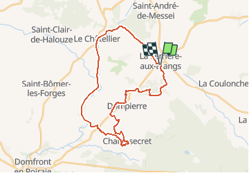
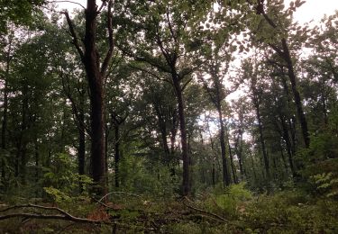
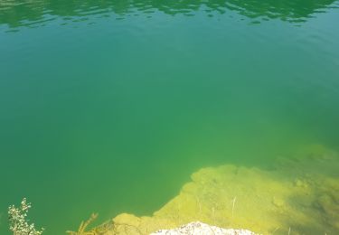
Trail Mountain bike of 32 km to be discovered at Normandy, Orne, La Ferrière-aux-Étangs. This trail is proposed by tracegps.

Description

Boucle autour de Banvou. Point de Départ : dans le centre de La Ferrière aux Etangs, sur la digue en bout du plan d'eau. Parcourt varié alternant sous bois, chemins creux du bocage, Voie Verte et chemin en lisière de foret.

Elevation profile

Positioning

Country:
France
Region :
Normandy
Department/Province :
Orne
Municipality :
La Ferrière-aux-Étangs
Location:
Unknown
Start:(UTM)
682721 ; 5392603 (30U) N.

Trails nearby

Trail Walking La Ferrière-aux-Étangs - Circuit of IRON by Yannick-p14-61 - Photo
Walking
yannick-p

Walking

Medium
(1)
La Ferrière-aux-Étangs, Normandy, Orne, France
13.3 km | 16.5 km-effort
3h 35min
Yes
Trail Walking La Coulonche - La coulonche - Photo
Walking
Elisabeth Neveu

Walking

Very easy
La Coulonche, Normandy, Orne, France
3.7 km | 4.9 km-effort
1h 22min
Yes
Trail Walking La Ferrière-aux-Étangs - La Ferrière - La Ferrière aux Etangs - Photo
Walking
tracegps

Walking

Medium
La Ferrière-aux-Étangs, Normandy, Orne, France
14.3 km | 17.9 km-effort
3h 4min
Yes
Trail Walking La Ferrière-aux-Étangs - 1h16 - Photo
Walking
Jeromefrando

Walking

Medium
La Ferrière-aux-Étangs, Normandy, Orne, France
6.4 km | 8.5 km-effort
1h 16min
Yes
Trail Walking Le Châtellier - chatellier - Photo
Walking
sitydomer

Walking

Medium
Le Châtellier, Normandy, Orne, France
6 km | 6.6 km-effort
1h 36min
Yes
Trail Walking Dompierre - mines - Photo
Walking
canal

Walking

Medium
Dompierre, Normandy, Orne, France
9.3 km | 11.6 km-effort
2h 47min
No
Trail Walking La Ferrière-aux-Étangs - La Feriere aux etant  - Photo
Walking
Elisabeth Neveu

Walking

Very easy
La Ferrière-aux-Étangs, Normandy, Orne, France
1.2 km | 1.3 km-effort
36min
Yes
Trail Walking Dompierre - Dompierre; trace GPS du 10/09/2019 - Photo
Walking
toporient

Walking

Very easy
Dompierre, Normandy, Orne, France
8.2 km | 10.2 km-effort
4h 30min
Yes
Trail Walking Dompierre - Dompierre longue - Photo
Walking
toporient

Walking

Medium
Dompierre, Normandy, Orne, France
8.3 km | 10 km-effort
2h 13min
Yes


Close
My subscriptions